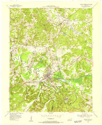
1954 Map of Dawson Springs
USGS Topo · Published 1955About this map
Dawson Springs serves as the hub of this 1954 topographic survey, where the Tradewater River winds through a landscape defined by mid-century extraction and public land management. Coal mining dominates the northern and eastern reaches, with numerous operations like the Dawson Daylight Strip Mine and Jenkins Strip Mines altering the terrain. The presence of the Illinois Central railroad suggests a robust industrial network moving coal and goods through the region.
Find a feature on this map
71 named features on this map. Tap any name to fly to it.
Don’t see what you’re looking for? This feature index may not catch every label — zoom into the map to look around manually.
Map Details
Editions of this 1954 Dawson Springs Map
This is the sole edition of this map. No revisions or reprints were ever made.
Other maps of this area

1907 · Earlington
USGS Topo · 1:48,000

1908 · Princeton
USGS Topo · 1:62,500

1909 · Dawson Springs
USGS Topo · 1:48,000

1909 · Earlington
USGS Topo · 1:62,500

1909 · Providence
USGS Topo · 1:62,500

1910 · Princeton
USGS Topo · 1:62,500

1911 · Dawson Springs
USGS Topo · 1:62,500

1953 · Dawson Springs SE
USGS Topo · 1:24,000

1953 · Dawson Springs SW
USGS Topo · 1:24,000

1954 · Evansville
USGS Topo · 1:250,000