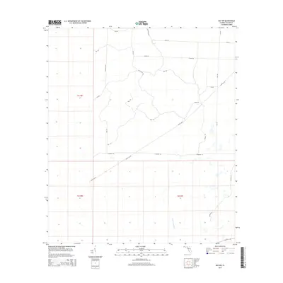
2015 Map of Day NW
USGS Topo · Published 2015About this map
The Fenholloway River meanders through this section of Taylor County, defining the southern drainage patterns of a landscape largely shaped by timber management and rural access. In the mid-2010s, the area is partitioned by an extensive network of named forest roads and utility corridors, reflecting the region's long-standing reliance on silviculture. Major arterial routes such as Power Line Rd and S Boundary Rd cut straight paths across the terrain, while more localized tracks like Rock Island Rd, Padgett Rd, and Granger Rd provide access to the interior. The grid-like organization of the Public Land Survey System, including t3s r8e and t4s r9e, underscores the systematic division of Florida's Big Bend interior for resource extraction and land management.
Find a feature on this map
23 named features on this map. Tap any name to fly to it.
Don’t see what you’re looking for? This feature index may not catch every label — zoom into the map to look around manually.
Map Details
Editions of this 2015 Day NW Map
This is the sole edition of this map. No revisions or reprints were ever made.
Other maps of this area

1954 · Fenholloway
USGS Topo · 1:24,000

1954 · Day SE
USGS Topo · 1:24,000

1954 · Day
USGS Topo · 1:24,000

1954 · Boyd
USGS Topo · 1:24,000

1954 · Day NW
USGS Topo · 1:24,000

1954 · Valdosta
USGS Topo · 1:250,000

1955 · Perry
USGS Topo · 1:24,000

1955 · Greenville SE
USGS Topo · 1:24,000

1958 · Valdosta
USGS Topo · 1:250,000

1958 · Madison SW
USGS Topo · 1:24,000