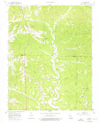
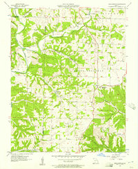
1955 Map of Day
USGS Topo · Published 1976About this map
Chestnut Ridge and the winding course of Bull Creek define the topography of this Ozark landscape as it appeared in the mid-1950s. The settlement of Day sits near the western edge, while a network of country churches including Oak Ridge Ch, Meadows Ch, and Pleasant Shade Ch anchor the scattered rural communities. The terrain is deeply incised by numerous hollows, such as Goodnight Hollow and Tantrough Hollow, reflecting a drainage pattern that moves toward the creek basins.
Find a feature on this map
37 named features on this map. Tap any name to fly to it.
Don’t see what you’re looking for? This feature index may not catch every label — zoom into the map to look around manually.
Map Details
Editions of this 1955 Day Map
4 editions found

Other maps of this area

1907 · Forsyth
USGS Topo · 1:125,000

1945 · Harrison
USGS Topo · 1:250,000

1949 · Harrison
USGS Topo · 1:250,000

1950 · Garber
USGS Topo · 1:24,000

1954 · Harrison
USGS Topo · 1:250,000

1955 · Garrison
USGS Topo · 1:24,000
1955 · Selmore
USGS Topo · 1:24,000
1955 · Chadwick
USGS Topo · 1:24,000

1955 · Day
USGS Topo · 1:24,000
1955 · Highlandville
USGS Topo · 1:24,000