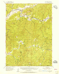
1954 Map of Days Creek
USGS Topo · Published 1956About this map
The South Umpqua River and Cow Creek define the geography of this mid-century Douglas County landscape, where small riverside communities and remote mountain outposts remain central to local life. Near the confluence of Days Creek, the settlement of the same name and the nearby Lavadoure Community Hall serve as focal points for the valley's residents. The map illustrates a transition from the lower agricultural and residential river banks to the dense timberlands of the Umpqua National Forest, which covers much of the southern and eastern territory. Local history is preserved in rural landmarks like the Bland Cemetery and educational sites including Galesville School and Anchor School. Resource extraction and forest management are evident through the Miller Mine and the Devils Flat Guard Sta, reflecting the era's reliance on both the earth and protected federal lands. The terrain is marked by prominent peaks such as Bland Mtn and Beal Mountain, accessible by early roads like Gazley Rd.
Find a feature on this map
65 named features on this map. Tap any name to fly to it.
Don’t see what you’re looking for? This feature index may not catch every label — zoom into the map to look around manually.
Map Details
Editions of this 1954 Days Creek Map
3 editions found
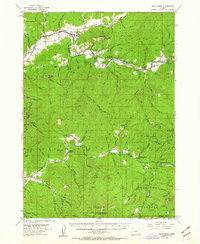
Other maps of this area

1891 · Ashland
USGS Topo · 1:250,000

1893 · Ashland
USGS Topo · 1:250,000

1897 · Roseburg
USGS Topo · 1:125,000

1897 · Ashland
USGS Topo · 1:250,000

1900 · Roseburg
USGS Topo · 1:125,000

1904 · Riddle
USGS Topo · 1:125,000

1943 · Trail
USGS Topo · 1:62,500

1944 · Tiller
USGS Topo · 1:62,500

1954 · Dixonville
USGS Topo · 1:62,500

1954 · Days Creek
USGS Topo · 1:62,500