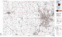
1986 Map of Dayton
USGS Topo · Published 1986About this map
The Great Miami River and its major tributaries, including the Stillwater River and Mad River, anchor this mid-1980s look at the urban and rural corridors connecting Southwest Ohio and East-Central Indiana. The landscape is defined by the strategic water management systems of the Miami Conservancy District, featuring critical infrastructure like the Englewood Reservoir and Germantown Reservoir. While the industrial centers of Dayton and Middletown show significant development, the western portions of the sheet remain largely agricultural, dotted with smaller hubs such as Eaton and the academic grounds of Miami University in Oxford.
Find a feature on this map
227 named features on this map. Tap any name to fly to it.
Don’t see what you’re looking for? This feature index may not catch every label — zoom into the map to look around manually.
Map Details
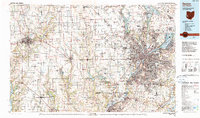
Editions of this 1986 Dayton Map
2 editions found
Other maps of this area

1904 · Springfield
USGS Topo · 1:62,500

1904 · Dayton
USGS Topo · 1:62,500

1904 · Mason
USGS Topo · 1:62,500

1905 · Brookville
USGS Topo · 1:62,500

1906 · Dayton
USGS Topo · 1:62,500

1906 · Mason
USGS Topo · 1:62,500

1906 · Springfield
USGS Topo · 1:62,500

1907 · Blanchester
USGS Topo · 1:62,500

1908 · Miamisburg
USGS Topo · 1:62,500

1911 · Covington
USGS Topo · 1:62,500