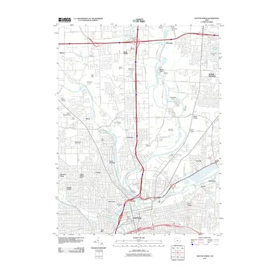
2010 Map of Dayton North
USGS Topo · Published 2010About this map
The Great Miami River, Stillwater River, and Mad River converge in this northern Dayton landscape, defining the city’s complex geography and historical development. The Taylorsville Dam and Ohnoname 19 Dam regulate the northern reaches near Taylorsville and Murlin Heights, while the Island Park Dam sits just above the urban core of Dayton. This area is dense with local history, preserved in numerous burial grounds such as the Friends Cemetery, Booher Cemetery, and the House of Jacob Cemetery.
Find a feature on this map
77 named features on this map. Tap any name to fly to it.
Don’t see what you’re looking for? This feature index may not catch every label — zoom into the map to look around manually.
Map Details
Editions of this 2010 Dayton North Map
This is the sole edition of this map. No revisions or reprints were ever made.
Other maps of this area

1904 · Dayton
USGS Topo · 1:62,500

1905 · Brookville
USGS Topo · 1:62,500

1906 · Dayton
USGS Topo · 1:62,500

1908 · Miamisburg
USGS Topo · 1:62,500

1913 · Waynesville
USGS Topo · 1:62,500

1915 · Waynesville
USGS Topo · 1:62,500

1953 · Cincinnati
USGS Topo · 1:250,000

1955 · Miamisburg
USGS Topo · 1:24,000

1955 · Dayton South
USGS Topo · 1:24,000
1955 · Bellbrook
USGS Topo · 1:24,000