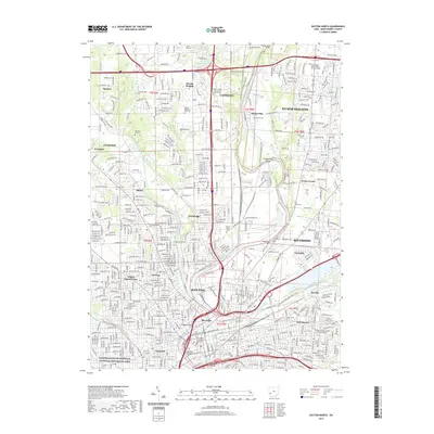
2019 Map of Dayton North
USGS Topo · Published 2019About this map
The Great Miami River and Mad River converge in the heart of Dayton, anchoring a dense urban and suburban landscape in Montgomery County. This contemporary survey details the historical core of the city, including the Dayton Aviation Heritage National Historical Park and the Montgomery County Courts Building. The map captures the northward expansion of the metro area into Huber Heights, Vandalia, and Clayton, showing how modern infrastructure follows the natural valleys of the Stillwater River and Wolf Creek.
Find a feature on this map
48 named features on this map. Tap any name to fly to it.
Don’t see what you’re looking for? This feature index may not catch every label — zoom into the map to look around manually.
Map Details
Editions of this 2019 Dayton North Map
This is the sole edition of this map. No revisions or reprints were ever made.
Other maps of this area

1904 · Dayton
USGS Topo · 1:62,500

1905 · Brookville
USGS Topo · 1:62,500

1906 · Dayton
USGS Topo · 1:62,500

1908 · Miamisburg
USGS Topo · 1:62,500

1913 · Waynesville
USGS Topo · 1:62,500

1915 · Waynesville
USGS Topo · 1:62,500

1953 · Cincinnati
USGS Topo · 1:250,000

1955 · Miamisburg
USGS Topo · 1:24,000

1955 · Dayton South
USGS Topo · 1:24,000
1955 · Bellbrook
USGS Topo · 1:24,000