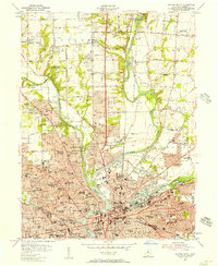
1955 Map of Dayton North
USGS Topo · Published 1957About this map
The confluence of the Miami River, Stillwater River, and Mad River anchors this mid-century portrait of Dayton's northern expansion. The Miami Conservancy District infrastructure is prominent, notably the Taylorsville Dam and its associated Taylorsville Reserve, designed to manage the waters that historically flooded the valley. The map reveals a dense network of institutional landmarks, including the Orville Wright Home, the United Theological Seminary, and the Barney Convalescent Hosp.
Find a feature on this map
163 named features on this map. Tap any name to fly to it.
Don’t see what you’re looking for? This feature index may not catch every label — zoom into the map to look around manually.
Map Details
Editions of this 1955 Dayton North Map
This is the sole edition of this map. No revisions or reprints were ever made.
Other maps of this area

1904 · Dayton
USGS Topo · 1:62,500

1905 · Brookville
USGS Topo · 1:62,500

1906 · Dayton
USGS Topo · 1:62,500

1908 · Miamisburg
USGS Topo · 1:62,500

1913 · Waynesville
USGS Topo · 1:62,500

1915 · Waynesville
USGS Topo · 1:62,500

1953 · Cincinnati
USGS Topo · 1:250,000

1955 · Miamisburg
USGS Topo · 1:24,000

1955 · Dayton South
USGS Topo · 1:24,000
1955 · Bellbrook
USGS Topo · 1:24,000