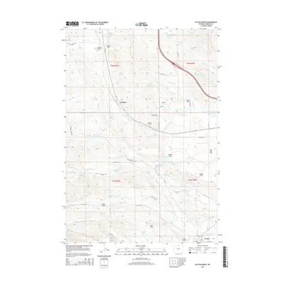
2015 Map of Dayton North
USGS Topo · Published 2015About this map
Parkman and the northern outskirts of Dayton define this high-plains landscape just east of the mountain front. This 2015 record shows a complex network of water management essential for ranching and agriculture in Sheridan County, featuring a high concentration of private and communal storage like Antwerp Reservoir, Barker Reservoir, and Huntington Reservoir. The terrain is deeply incised by drainages such as Grande Gulch, Gannon Draw, and Jack Bill Draw, which flow toward the Tongue River valley. A dense system of irrigation infrastructure, including the Fivemile Ditch, Brand Point Ditch, and Owens Ditch, illustrates how the local economy utilizes the runoff from the nearby heights. Regional transit is centered on the corridor of Interstate 90, which cuts a path near Sixmile Cr, while local routes like Pass Creek Rd and Twin Creek Rd provide access to the surrounding draws and gulches.
Find a feature on this map
64 named features on this map. Tap any name to fly to it.
Don’t see what you’re looking for? This feature index may not catch every label — zoom into the map to look around manually.
Map Details
Editions of this 2015 Dayton North Map
This is the sole edition of this map. No revisions or reprints were ever made.
Other maps of this area

1894 · Rosebud
USGS Topo · 1:125,000

1895 · Dayton
USGS Topo · 1:125,000

1901 · Rosebud
USGS Topo · 1:125,000

1901 · Dayton
USGS Topo · 1:125,000

1954 · Hardin
USGS Topo · 1:250,000

1955 · Sheridan
USGS Topo · 1:250,000

1957 · Hardin
USGS Topo · 1:250,000

1958 · Hardin
USGS Topo · 1:250,000

1958 · Sheridan
USGS Topo · 1:250,000

1962 · Sheridan
USGS Topo · 1:250,000