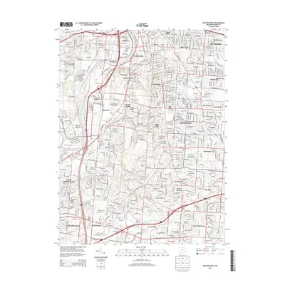
2013 Map of Dayton South
USGS Topo · Published 2013About this map
The Great Miami River anchors this detailed urban and suburban landscape, winding past the historical core of Dayton and its southern neighbors. Industrial and academic foundations are prominent, featuring the University of Dayton campus and Welcome Stadium, alongside the transit corridors of Csx Transportation and Norfolk Southern. The map documents a dense network of neighborhoods ranging from the established streets of Oakwood and Kettering to newer developments like Wittes Corners and Shanersville.
Find a feature on this map
147 named features on this map. Tap any name to fly to it.
Don’t see what you’re looking for? This feature index may not catch every label — zoom into the map to look around manually.
Map Details
Editions of this 2013 Dayton South Map
This is the sole edition of this map. No revisions or reprints were ever made.
Other maps of this area

1904 · Dayton
USGS Topo · 1:62,500

1905 · Brookville
USGS Topo · 1:62,500

1906 · Dayton
USGS Topo · 1:62,500

1908 · Miamisburg
USGS Topo · 1:62,500

1913 · Waynesville
USGS Topo · 1:62,500

1915 · Waynesville
USGS Topo · 1:62,500

1951 · Franklin
USGS Topo · 1:24,000

1953 · Cincinnati
USGS Topo · 1:250,000

1955 · Miamisburg
USGS Topo · 1:24,000
1955 · Waynesville
USGS Topo · 1:24,000