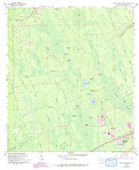
1962 Map of Daytona Beach NW
USGS Topo · Published 1993About this map
Rima Ridge and Gopher Ridge define the interior landscape of this central Florida region, situated west of the Atlantic coast. The map illustrates a complex network of wetlands and seasonal drainages, including Bennett Swamp and the sprawling Tiger Bay. These hydrologic features, such as Stooping Saplings and Wampee Strand, reveal the natural drainage patterns of Volusia County before extensive modern development.
Find a feature on this map
45 named features on this map. Tap any name to fly to it.
Don’t see what you’re looking for? This feature index may not catch every label — zoom into the map to look around manually.
Map Details
Editions of this 1962 Daytona Beach NW Map
5 editions found
Other maps of this area

1937 · Ormond
USGS Topo · 1:48,000

1944 · Ormond
USGS Topo · 1:62,500

1952 · Samsula
USGS Topo · 1:24,000

1952 · Daytona Beach
USGS Topo · 1:24,000

1954 · Daytona Beach
USGS Topo · 1:250,000

1956 · Favoretta
USGS Topo · 1:24,000

1956 · Ormond Beach
USGS Topo · 1:24,000

1958 · Daytona Beach
USGS Topo · 1:250,000

1962 · Daytona Beach NW
USGS Topo · 1:24,000

1962 · Daytona Beach SW
USGS Topo · 1:24,000