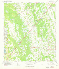
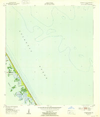
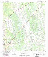
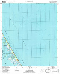
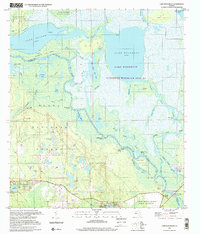
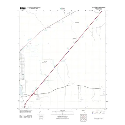
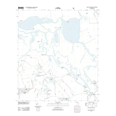
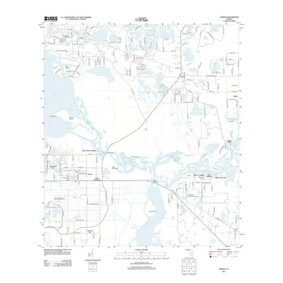
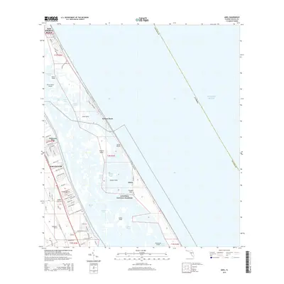
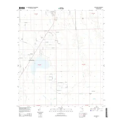
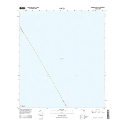
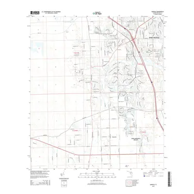
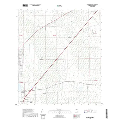
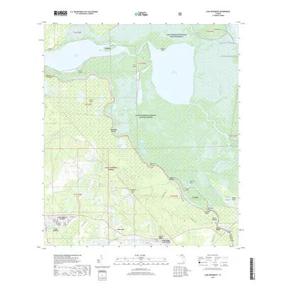
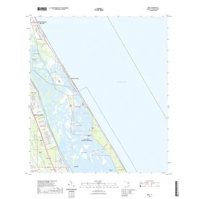
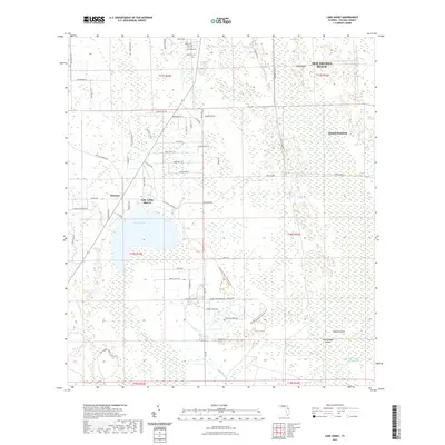
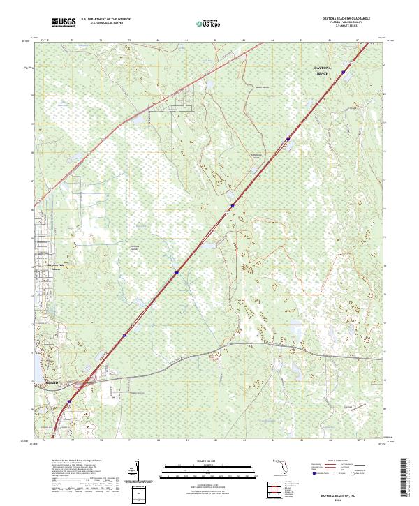
1962 Map of Daytona Beach SW
USGS Topo · Published 1976About this map
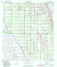
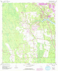
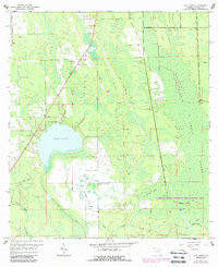
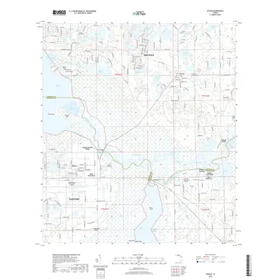
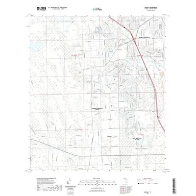
Daytona Park Estates represents the primary residential development in this 1960s landscape, featuring a grid of streets including Central Parkway, Iris Road, and Orange Road. The surrounding environment is defined by complex water systems and marshlands, notably the expanses of Tiger Bay and Akins Bay to the east. The terrain is characterized by numerous unnamed islands and the distinct Rattlesnake Island, indicating a low-lying, swampy topography typical of the Florida interior during this era.
Find a feature on this map
26 named features on this map. Tap any name to fly to it.
Don’t see what you’re looking for? This feature index may not catch every label — zoom into the map to look around manually.
Map Details
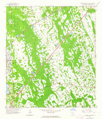
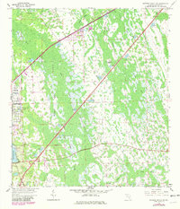
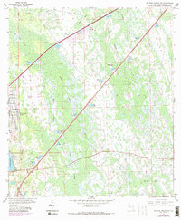
Editions of this 1962 Daytona Beach SW Map
5 editions found
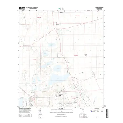
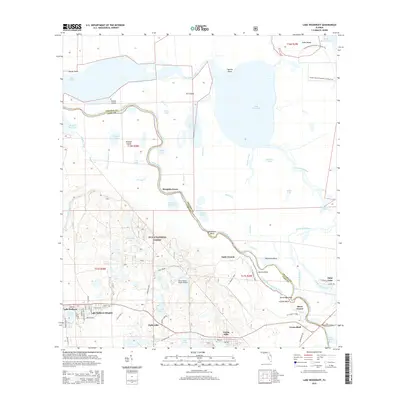
Historical Maps of Lake Helen Through Time
88 maps found
1949 Osceola
Volusia County, FL
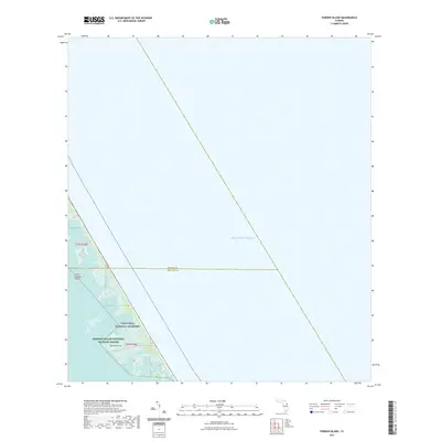
1949 Pardon Island
Volusia County, FL
1950 Ariel
Volusia County, FL
1950 Maytown
Volusia County, FL
1952 Pardon Island
Volusia County, FL
1952 Samsula
Volusia County, FL
1956 Flagler Beach East
Volusia County, FL
1962 Daytona Beach NW
Volusia County, FL
1962 Daytona Beach SW
Volusia County, FL
1962 Lake Woodruff
Volusia County, FL
1964 De Land
Volusia County, FL
1965 Osteen
Volusia County, FL
1966 Lake Ashby
Volusia County, FL
1966 Osceola
Volusia County, FL
1970 Welaka SE
Volusia County, FL
1971 Lake Dias
Volusia County, FL
1994 Pardon Island
Volusia County, FL
1999 Lake Woodruff
Volusia County, FL
2012 Ariel
Volusia County, FL
2012 Daytona Beach NW
Volusia County, FL
2012 Daytona Beach SW
Volusia County, FL
2012 Flagler Beach East
Volusia County, FL
2012 Lake Ashby
Volusia County, FL
2012 Lake Dias
Volusia County, FL
2012 Lake Woodruff
Volusia County, FL
2012 Maytown
Volusia County, FL
2012 New Smyrna Beach OE E
Volusia County, FL
2012 Osceola
Volusia County, FL
2012 Osteen
Volusia County, FL
2012 Pardon Island
Volusia County, FL
2012 Samsula
Volusia County, FL
2012 Welaka SE
Volusia County, FL
2015 Ariel
Volusia County, FL
2015 Daytona Beach NW
Volusia County, FL
2015 Daytona Beach SW
Volusia County, FL
2015 Flagler Beach East
Volusia County, FL
2015 Lake Ashby
Volusia County, FL
2015 Lake Dias
Volusia County, FL
2015 Lake Woodruff
Volusia County, FL
2015 Maytown
Volusia County, FL
2015 New Smyrna Beach OE E
Volusia County, FL
2015 Osceola
Volusia County, FL
2015 Osteen
Volusia County, FL
2015 Pardon Island
Volusia County, FL
2015 Samsula
Volusia County, FL
2015 Welaka SE
Volusia County, FL
2018 Ariel
Volusia County, FL
2018 Daytona Beach NW
Volusia County, FL
2018 Daytona Beach SW
Volusia County, FL
2018 Flagler Beach East
Volusia County, FL
2018 Lake Ashby
Volusia County, FL
2018 Lake Dias
Volusia County, FL
2018 Lake Woodruff
Volusia County, FL
2018 Maytown
Volusia County, FL
2018 New Smyrna Beach OE E
Volusia County, FL
2018 Osceola
Volusia County, FL
2018 Osteen
Volusia County, FL
2018 Pardon Island
Volusia County, FL
2018 Samsula
Volusia County, FL
2018 Welaka SE
Volusia County, FL
2021 Ariel
Volusia County, FL
2021 Daytona Beach NW
Volusia County, FL
2021 Daytona Beach SW
Volusia County, FL
2021 Flagler Beach East
Volusia County, FL
2021 Lake Ashby
Volusia County, FL
2021 Lake Dias
Volusia County, FL
2021 Lake Woodruff
Volusia County, FL
2021 Maytown
Volusia County, FL
2021 New Smyrna Beach OE E
Volusia County, FL
2021 Osceola
Volusia County, FL
2021 Osteen
Volusia County, FL
2021 Pardon Island
Volusia County, FL
2021 Samsula
Volusia County, FL
2021 Welaka SE
Volusia County, FL
2024 Ariel
Volusia County, FL
2024 Daytona Beach NW
Volusia County, FL
2024 Daytona Beach SW
Volusia County, FL
2024 Flagler Beach East
Volusia County, FL
2024 Lake Ashby
Volusia County, FL
2024 Lake Dias
Volusia County, FL
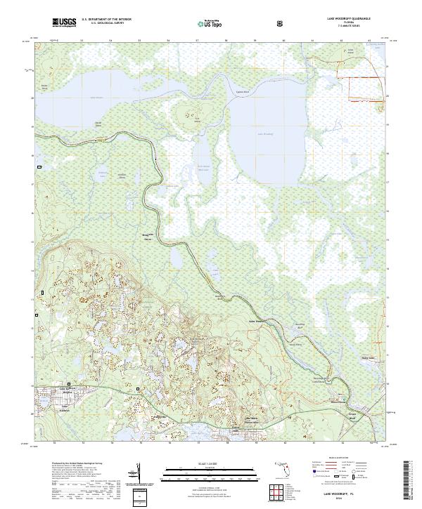
2024 Lake Woodruff
Volusia County, FL
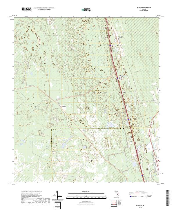
2024 Maytown
Volusia County, FL
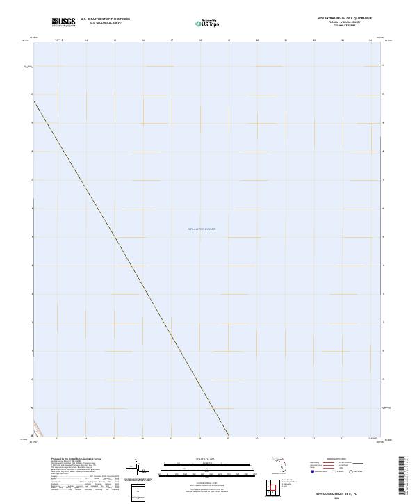
2024 New Smyrna Beach OE E
Volusia County, FL
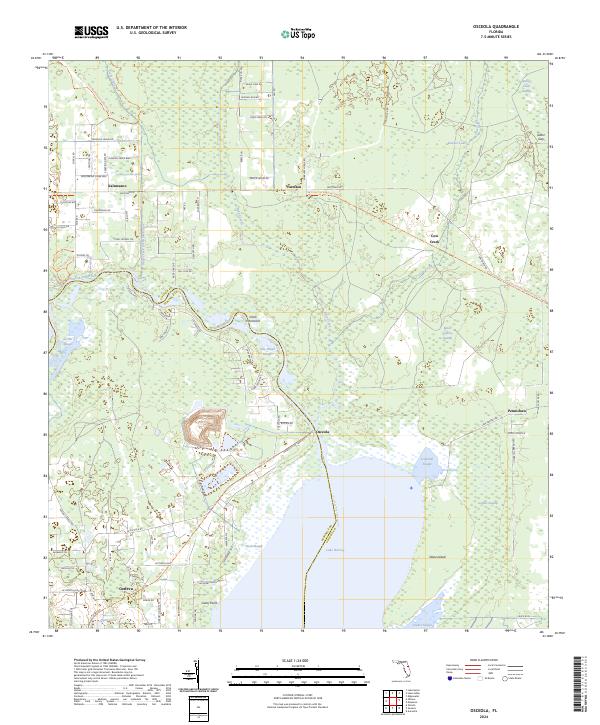
2024 Osceola
Volusia County, FL
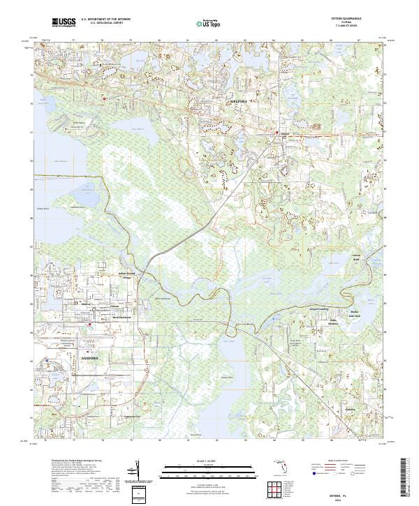
2024 Osteen
Volusia County, FL
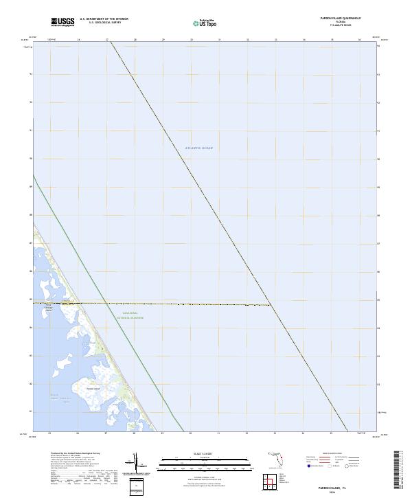
2024 Pardon Island
Volusia County, FL
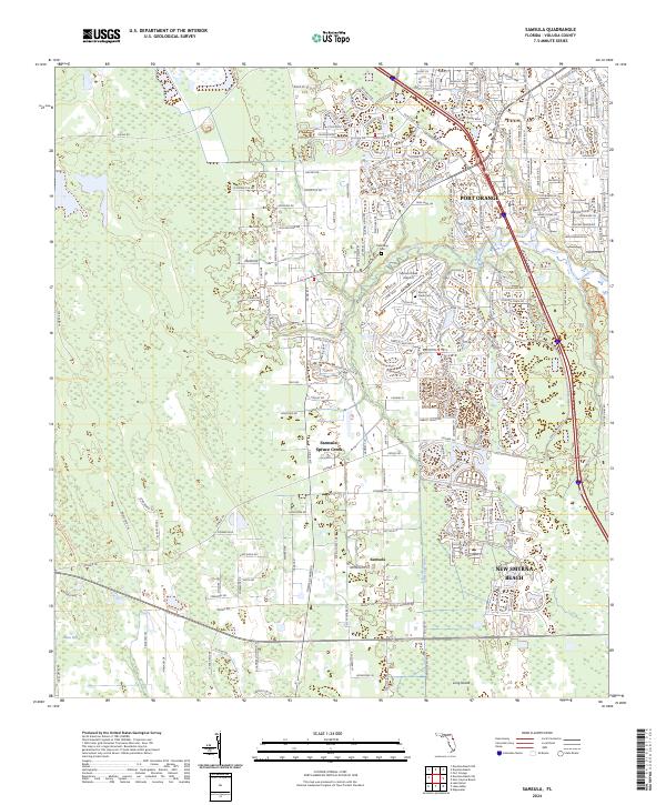
2024 Samsula
Volusia County, FL
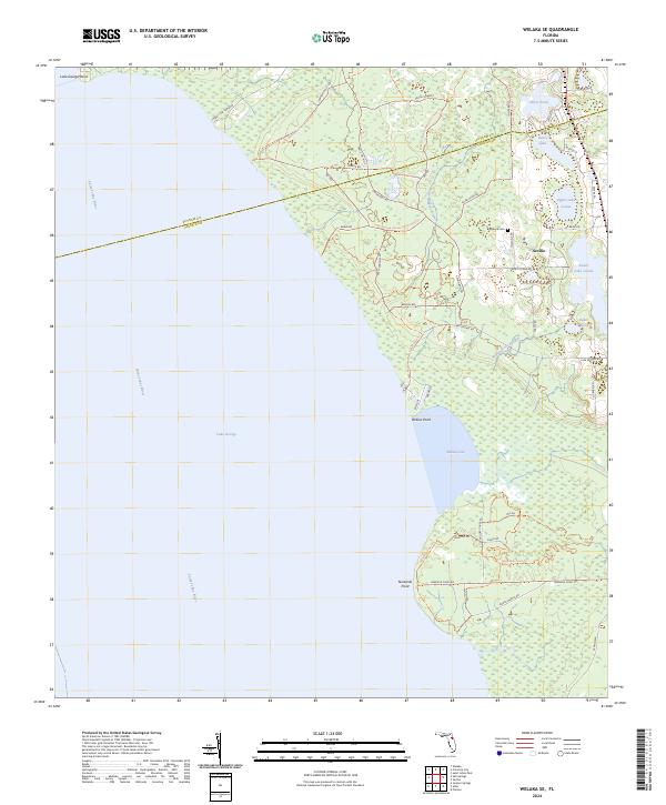
2024 Welaka SE
Volusia County, FL