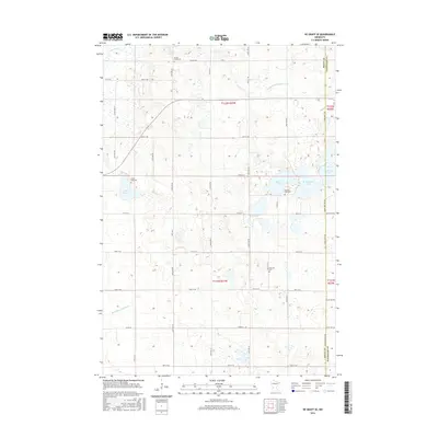
2016 Map of De Graff SE
USGS Topo · Published 2016About this map
Spring Creek Cem and Hillcrest Cem anchor the rural landscape of western Kandiyohi County in this 2016 survey. The terrain is defined by a dense network of glacial lakes and drainage systems, most notably Monson Lake and Lake Frank. Water management is central to the area's geography, evidenced by the engineered path of County Ditch Number One and the Hollerberg Floodway, which underscore the region's agricultural focus. The boundary between Swift and Kandiyohi counties cuts through the eastern portion of the sheet, where Sunburg Lake and W Sunburg Lake straddle the line. This modern topographic record captures the enduring rural character of these Minnesota townships, where family history is preserved at sites like Frank Lake Cem and Monson Lake Cem amidst a patchwork of section roads and prairie potholes.
Find a feature on this map
26 named features on this map. Tap any name to fly to it.
Don’t see what you’re looking for? This feature index may not catch every label — zoom into the map to look around manually.
Map Details
Editions of this 2016 De Graff SE Map
This is the sole edition of this map. No revisions or reprints were ever made.
Other maps of this area

1953 · Saint Cloud
USGS Topo · 1:250,000

1957 · Saint Cloud
USGS Topo · 1:250,000

1958 · Saint Cloud
USGS Topo · 1:250,000

1958 · Murdock
USGS Topo · 1:24,000

1958 · Kerkhoven
USGS Topo · 1:24,000

1958 · Pennock
USGS Topo · 1:24,000

1967 · Sunburg
USGS Topo · 1:24,000

1967 · Lake Johanna
USGS Topo · 1:24,000

1968 · De Graff
USGS Topo · 1:24,000

1968 · Lake Simon
USGS Topo · 1:24,000