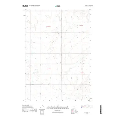
2017 Map of De Grey NE
USGS Topo · Published 2017About this map
Chapelle Cr winds through the southeastern corner of this Hughes County landscape, defining the primary drainage for a region characterized by a systematic grid of section lines. This 2017 survey by the U.S. Geological Survey illustrates a highly organized rural infrastructure, where long-distance corridors like Co Rd 202 and 200th St provide the backbone for agricultural transit. The mapping reflects a modern era of land management, showing the precise intersection of numbered townships and ranges such as t112n r75w and t111n r74w. While the area is largely dominated by open terrain, the network of gravel roads including 315th Ave and 320th Ave suggests a landscape of active farmsteads and field access points typical of the South Dakota plains.
Find a feature on this map
18 named features on this map. Tap any name to fly to it.
Don’t see what you’re looking for? This feature index may not catch every label — zoom into the map to look around manually.
Map Details
Editions of this 2017 De Grey NE Map
This is the sole edition of this map. No revisions or reprints were ever made.
Other maps of this area

1953 · Huron
USGS Topo · 1:250,000

1954 · Huron
USGS Topo · 1:250,000

1967 · Blunt
USGS Topo · 1:24,000

1967 · Blunt SE
USGS Topo · 1:24,000

1967 · De Grey NE
USGS Topo · 1:24,000
1967 · De Grey NW
USGS Topo · 1:24,000

1968 · Harrold
USGS Topo · 1:24,000

1973 · De Grey SE
USGS Topo · 1:24,000
1973 · De Grey
USGS Topo · 1:24,000

1973 · Chapelle Lake SW
USGS Topo · 1:24,000