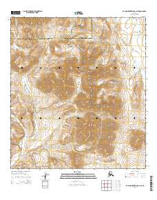
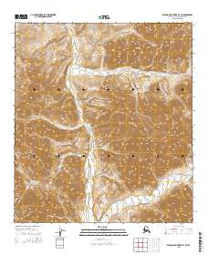
2015 Map of De Long Mountains A-2 NE
USGS Topo · Published 2015About this map
Noatak National Preserve encompasses a significant portion of this Arctic landscape, where high-altitude peaks like Mt Raven dominate the topography. The terrain is defined by its drainage systems, most notably the winding course of Ikalukrok Creek and its tributary Ikalukrok Cr in the southwest, and Wrench Cr in the northeast. This 2015 U.S. Geological Survey representation reveals a region where human infrastructure is largely absent, marked instead by the administrative boundary between the North Slope Borough and Northwest Arctic Borough. The map captures the complex contouring of the De Long Mountains, providing a detailed look at the watersheds that shape this protected wilderness. For those studying the remote geography of the Alaskan north, it offers a precise record of the natural landmarks and borough divisions that partition the interior.
Find a feature on this map
10 named features on this map. Tap any name to fly to it.
Don’t see what you’re looking for? This feature index may not catch every label — zoom into the map to look around manually.
Map Details
Editions of this 2015 De Long Mountains A-2 NE Map
This is the sole edition of this map. No revisions or reprints were ever made.
Other maps of this area

1951 · De Long Mountains
USGS Topo · 1:250,000

1955 · De Long Mountains
USGS Topo · 1:250,000

1955 · De Long Mountains A-1
USGS Topo · 1:63,360

1955 · De Long Mountains A-2
USGS Topo · 1:63,360

1955 · De Long Mountains B-2
USGS Topo · 1:63,360
1955 · De Long Mountains B-1
USGS Topo · 1:63,360

1965 · De Long Mountains
USGS Topo · 1:250,000
2015 · De Long Mountains A-2 NW
USGS Topo · 1:25,000
2015 · De Long Mountains B-2 SE
USGS Topo · 1:25,000
2015 · De Long Mountains B-2 SW
USGS Topo · 1:25,000