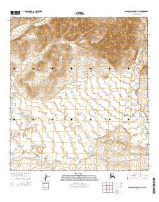
2015 Map of De Long Mountains A-3 SW
USGS Topo · Published 2015About this map
W Fork Wulik River defines the drainage patterns of this remote northern landscape, cutting through the high country of the western De Long Mountains. This 2015 survey, produced by the U.S. Geological Survey in cooperation with the Alaska Dept. of Transportation, provides a clear view of the complex topography within the Northwest Arctic Borough. The map records the precise Public Land Survey System divisions, including Townships 32 North, Range 22 West and 31 North, Range 21 West, documenting the uninhabited terrain before any significant modern infrastructure development. It serves as a vital record of the natural contours and hydrologic flow in a region defined by its unpopulated wilderness and seasonal watercourses.
Find a feature on this map
7 named features on this map. Tap any name to fly to it.
Don’t see what you’re looking for? This feature index may not catch every label — zoom into the map to look around manually.
Map Details
Editions of this 2015 De Long Mountains A-3 SW Map
This is the sole edition of this map. No revisions or reprints were ever made.
Other maps of this area

1951 · De Long Mountains
USGS Topo · 1:250,000

1951 · Noatak
USGS Topo · 1:250,000

1955 · Noatak
USGS Topo · 1:250,000

1955 · De Long Mountains
USGS Topo · 1:250,000

1955 · Noatak D-4
USGS Topo · 1:63,360

1955 · Noatak D-3
USGS Topo · 1:63,360

1955 · De Long Mountains A-3
USGS Topo · 1:63,360

1955 · De Long Mountains A-4
USGS Topo · 1:63,360

1964 · Noatak
USGS Topo · 1:250,000

1965 · De Long Mountains
USGS Topo · 1:250,000