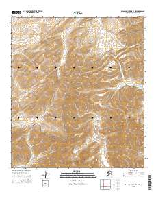
2015 Map of De Long Mountains B-1 NW
USGS Topo · Published 2015About this map
The Noatak National Preserve encompasses the southeastern portion of this landscape, marking a protected wilderness area within the Arctic. This 2015 study focuses on the high-latitude drainage systems of the De Long Mountains, where the headwaters of several significant North Slope waterways emerge. The northern flow of the Tingmerkpuk River and the Kukpowruk River dominate the western half of the sheet, while the Kelly River drains toward the east. The terrain is defined by the complex hydrography of the Brooks Range foothills, including the smaller Wrench Cr. This map documents the remote hydrology and land management boundaries within the North Slope Borough, providing a precise record of the natural contours and river channels as they existed at the start of the 21st century.
Find a feature on this map
12 named features on this map. Tap any name to fly to it.
Don’t see what you’re looking for? This feature index may not catch every label — zoom into the map to look around manually.
Map Details
Editions of this 2015 De Long Mountains B-1 NW Map
This is the sole edition of this map. No revisions or reprints were ever made.
Other maps of this area

1951 · De Long Mountains
USGS Topo · 1:250,000

1955 · De Long Mountains
USGS Topo · 1:250,000
1955 · De Long Mountains C-2
USGS Topo · 1:63,360
1955 · De Long Mountains C-1
USGS Topo · 1:63,360

1955 · De Long Mountains B-2
USGS Topo · 1:63,360
1955 · De Long Mountains B-1
USGS Topo · 1:63,360

1965 · De Long Mountains
USGS Topo · 1:250,000
2015 · De Long Mountains B-2 SE
USGS Topo · 1:25,000
2015 · De Long Mountains C-1 SE
USGS Topo · 1:25,000
2015 · De Long Mountains C-1 SW
USGS Topo · 1:25,000