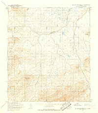
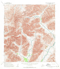
1955 Map of De Long Mountains C-1
USGS Topo · Published 1967About this map
Tingmerkpuk Mountain dominates the southwestern quadrant of this Arctic landscape, its elevation surveyed amidst a network of northward-flowing water systems. This mid-1950s record captures a remote portion of the North Slope where the Tingmerkpuk River and Kokolik River snake through largely unsurveyed territory. The map reflects a moment in time when much of the land remained unmarked by infrastructure, with topographical data derived from aerial photography and limited field annotation. Geologic and geographic study is focused on the subtle landforms of the Brooks Range foothills, including the long expanse of Sulungatak Ridge. Braided channels and marshy terrain surround Surprise Creek in the north, illustrating the characteristic drainage patterns of the tundra before more modern human impacts reached this region.
Find a feature on this map
6 named features on this map. Tap any name to fly to it.
Don’t see what you’re looking for? This feature index may not catch every label — zoom into the map to look around manually.
Map Details
Editions of this 1955 De Long Mountains C-1 Map
2 editions found
Other maps of this area

1951 · De Long Mountains
USGS Topo · 1:250,000

1951 · Misheguk Mountain
USGS Topo · 1:250,000

1955 · De Long Mountains
USGS Topo · 1:250,000

1955 · De Long Mountains D-2
USGS Topo · 1:63,360
1955 · De Long Mountains D-1
USGS Topo · 1:63,360
1955 · De Long Mountains C-2
USGS Topo · 1:63,360

1955 · De Long Mountains B-2
USGS Topo · 1:63,360
1955 · De Long Mountains B-1
USGS Topo · 1:63,360

1956 · Misheguk Mountain
USGS Topo · 1:250,000

1965 · De Long Mountains
USGS Topo · 1:250,000