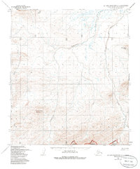
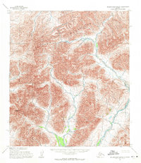
1955 Map of De Long Mountains C-1
USGS Topo · Published 1985About this map
Tingmerkpuk Mountain rises above a wilderness landscape defined by a complex network of Arctic drainages in this mid-century survey of the North Slope. The terrain is dominated by the north-flowing Tingmerkpuk River and the braided channels of the Kokolik River, which wind through a high-relief environment of ridges and steep valleys. To the east, the Sulungatak Ridge provides a significant topographic boundary, while the southern portion of the sheet is governed by the Noatak National Wilderness Preserve Boundary, a designation formally established later by the Alaska National Interest Lands Conservation Act.
Find a feature on this map
8 named features on this map. Tap any name to fly to it.
Don’t see what you’re looking for? This feature index may not catch every label — zoom into the map to look around manually.
Map Details
Editions of this 1955 De Long Mountains C-1 Map
2 editions found
Other maps of this area

1951 · De Long Mountains
USGS Topo · 1:250,000

1951 · Misheguk Mountain
USGS Topo · 1:250,000

1955 · De Long Mountains
USGS Topo · 1:250,000

1955 · De Long Mountains D-2
USGS Topo · 1:63,360
1955 · De Long Mountains D-1
USGS Topo · 1:63,360
1955 · De Long Mountains C-2
USGS Topo · 1:63,360
1955 · De Long Mountains C-1
USGS Topo · 1:63,360

1955 · De Long Mountains B-2
USGS Topo · 1:63,360
1955 · De Long Mountains B-1
USGS Topo · 1:63,360

1956 · Misheguk Mountain
USGS Topo · 1:250,000