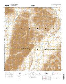
2015 Map of De Long Mountains B-1 SE
USGS Topo · Published 2015About this map
Noatak National Preserve encompasses the majority of this landscape, where the high-latitude terrain is defined by the drainage of the Kelly River. The survey illustrates the stark, unpopulated character of the Arctic wilderness within the De Long Mountains during the mid-2010s. A significant administrative line bisects the area, marking the boundary between the North Slope Borough and the Northwest Arctic Borough. This boundary transition represents the jurisdictional shift between two of Alaska's largest and most remote municipal divisions. The map provides a detailed view of the natural relief and hydrologic patterns in a region where topography dictates the flow of water and travel, entirely devoid of roads or permanent settlements.
Find a feature on this map
11 named features on this map. Tap any name to fly to it.
Don’t see what you’re looking for? This feature index may not catch every label — zoom into the map to look around manually.
Map Details
Editions of this 2015 De Long Mountains B-1 SE Map
This is the sole edition of this map. No revisions or reprints were ever made.
Other maps of this area

1951 · De Long Mountains
USGS Topo · 1:250,000

1951 · Misheguk Mountain
USGS Topo · 1:250,000

1955 · De Long Mountains
USGS Topo · 1:250,000

1955 · Misheguk Mountain A-5
USGS Topo · 1:63,360

1955 · De Long Mountains A-1
USGS Topo · 1:63,360
1955 · De Long Mountains B-1
USGS Topo · 1:63,360

1956 · Misheguk Mountain
USGS Topo · 1:250,000

1965 · De Long Mountains
USGS Topo · 1:250,000
1990 · Misheguk Mountain B-5
USGS Topo · 1:63,360
2015 · De Long Mountains A-1 NE
USGS Topo · 1:25,000