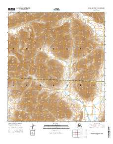
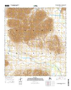
2015 Map of De Long Mountains B-1 SW
USGS Topo · Published 2015About this map
Noatak National Preserve encompasses much of this remote Arctic landscape, where the boundary between the North Slope Borough and Northwest Arctic Borough divides the high tundra. The terrain is defined by dramatic elevation changes, notably at Amphitheatre Mtn in the northwest, which rises sharply above the surrounding drainage basins. This 2015 survey details a wilderness devoid of modern infrastructure, focusing instead on the natural hydrology and topographical relief of the Brooks Range foothills. Watercourses like Wrench Cr carve through the northern sections of the quadrangle, illustrating the complex drainage patterns that characterize this protected region of Alaska. The map serves as a primary record of the physical geography and administrative jurisdictional lines in one of the most secluded parts of the American north.
Find a feature on this map
4 named features on this map. Tap any name to fly to it.
Don’t see what you’re looking for? This feature index may not catch every label — zoom into the map to look around manually.
Map Details
Editions of this 2015 De Long Mountains B-1 SW Map
This is the sole edition of this map. No revisions or reprints were ever made.
Other maps of this area

1951 · De Long Mountains
USGS Topo · 1:250,000

1955 · De Long Mountains
USGS Topo · 1:250,000

1955 · De Long Mountains A-1
USGS Topo · 1:63,360

1955 · De Long Mountains A-2
USGS Topo · 1:63,360

1955 · De Long Mountains B-2
USGS Topo · 1:63,360
1955 · De Long Mountains B-1
USGS Topo · 1:63,360

1965 · De Long Mountains
USGS Topo · 1:250,000
2015 · De Long Mountains B-2 SE
USGS Topo · 1:25,000
2015 · De Long Mountains A-1 NE
USGS Topo · 1:25,000
2015 · De Long Mountains A-1 NW
USGS Topo · 1:25,000