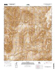
2014 Map of De Long Mountains B-5 NE
USGS Topo · Published 2014About this map
North Slope wilderness within the De Long Mountains defines this 2014 survey, which focuses on the complex topography and public land subdivisions of this remote Alaskan interior. The landscape is primarily organized by the Public Land Survey System, with the map providing detailed elevation contours for the upland drainages and ridges across T11s R54w and T12s R54w. As an early 21st-century digital-era topographic record, it integrates imagery from SPOT and hydrography from the National Hydrography Dataset to document a terrain largely devoid of modern road infrastructure or named settlements. The map serves as a primary reference for the geographic boundaries of T11s R55w and surrounding townships, capturing the undeveloped state of this arctic region before potential future shifts in land use or environmental change.
Find a feature on this map
6 named features on this map. Tap any name to fly to it.
Don’t see what you’re looking for? This feature index may not catch every label — zoom into the map to look around manually.
Map Details
Editions of this 2014 De Long Mountains B-5 NE Map
This is the sole edition of this map. No revisions or reprints were ever made.
Other maps of this area

1951 · De Long Mountains
USGS Topo · 1:250,000

1955 · De Long Mountains
USGS Topo · 1:250,000

1955 · De Long Mountains C-4
USGS Topo · 1:63,360

1955 · De Long Mountains C-5
USGS Topo · 1:63,360
1955 · De Long Mountains B-5
USGS Topo · 1:63,360
1955 · De Long Mountains B-4
USGS Topo · 1:63,360

1965 · De Long Mountains
USGS Topo · 1:250,000
2014 · De Long Mountains C-5 SW
USGS Topo · 1:25,000
2014 · De Long Mountains C-5 SE
USGS Topo · 1:25,000
2014 · De Long Mountains C-4 SW
USGS Topo · 1:25,000