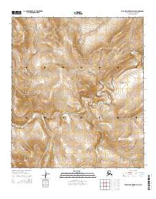
2014 Map of De Long Mountains C-5 SE
USGS Topo · Published 2014About this map
Ipewik River carves a winding path through this corner of the North Slope, defining the local drainage patterns across the De Long Mountains. This terrain is characterized by a complex network of high ridges and narrow valleys, where the river serves as the primary hydrological feature within the remote landscape. The map provides a precise look at the township and range divisions, specifically covering portions of t9s r54w, t10s r54w, and t11s r54w. These surveying lines provide a framework for understanding land distribution in a region where elevation and water flow remain the most prominent physical markers of the territory.
Find a feature on this map
10 named features on this map. Tap any name to fly to it.
Don’t see what you’re looking for? This feature index may not catch every label — zoom into the map to look around manually.
Map Details
Editions of this 2014 De Long Mountains C-5 SE Map
This is the sole edition of this map. No revisions or reprints were ever made.
Other maps of this area

1951 · De Long Mountains
USGS Topo · 1:250,000

1955 · De Long Mountains
USGS Topo · 1:250,000

1955 · De Long Mountains C-4
USGS Topo · 1:63,360

1955 · De Long Mountains C-5
USGS Topo · 1:63,360
1955 · De Long Mountains B-5
USGS Topo · 1:63,360
1955 · De Long Mountains B-4
USGS Topo · 1:63,360

1965 · De Long Mountains
USGS Topo · 1:250,000
2014 · De Long Mountains C-5 SW
USGS Topo · 1:25,000
2014 · De Long Mountains C-4 NW
USGS Topo · 1:25,000
2014 · De Long Mountains C-5 NE
USGS Topo · 1:25,000