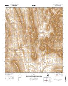
2014 Map of De Long Mountains B-5 NW
USGS Topo · Published 2014About this map
The De Long Mountains in the North Slope Borough of Alaska are presented in this 2014 survey through intricate topographic detail. This map focuses primarily on the intersection of four major townships including T11s R56w, T11s R55w, T12s R56w, and T12s R55w. The landscape is defined by high-elevation terrain and watershed patterns typical of the Arctic foothills, lacking any permanent named settlements or industrial infrastructure. The lack of man-made landmarks in this remote section of the borough reflects the preservation of natural boundaries and the vastness of the public land survey system in Northern Alaska. Researchers can study the drainage patterns and elevation contours that define the physical geography of this uninhabited wilderness area at the start of the twenty-first century.
Find a feature on this map
4 named features on this map. Tap any name to fly to it.
Don’t see what you’re looking for? This feature index may not catch every label — zoom into the map to look around manually.
Map Details
Editions of this 2014 De Long Mountains B-5 NW Map
This is the sole edition of this map. No revisions or reprints were ever made.
Other maps of this area

1951 · De Long Mountains
USGS Topo · 1:250,000

1952 · Point Hope
USGS Topo · 1:250,000

1955 · De Long Mountains
USGS Topo · 1:250,000

1955 · Point Hope
USGS Topo · 1:250,000

1955 · Point Hope C-1
USGS Topo · 1:63,360

1955 · Point Hope B-1
USGS Topo · 1:63,360

1955 · De Long Mountains C-5
USGS Topo · 1:63,360
1955 · De Long Mountains B-5
USGS Topo · 1:63,360

1965 · Point Hope
USGS Topo · 1:250,000

1965 · De Long Mountains
USGS Topo · 1:250,000