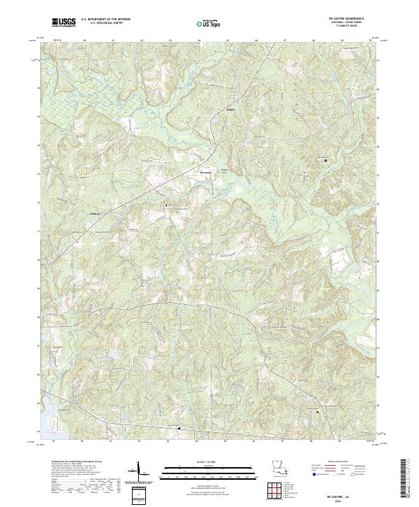
2024 Map of De Loutre
USGS Topo · Published 2024About this map
Bayou de Loutre meanders through this portion of Union Parish, defining a landscape of low-lying wetlands and complex tributary systems like Horse Pen Creek and Owens Creek. The settlement pattern is characterized by small, dispersed communities such as De Loutre, Quigley, and Canbeal, linked by a network of parish roads that follow the rise and fall of the terrain. A notable point of historical interest is Defees Ferry, located where the bayou narrows, suggesting an earlier era of water-based transit before modern bridge crossings became standard.
Find a feature on this map
97 named features on this map. Tap any name to fly to it.
Don’t see what you’re looking for? This feature index may not catch every label — zoom into the map to look around manually.
Map Details
Editions of this 2024 De Loutre Map
This is the sole edition of this map. No revisions or reprints were ever made.
Other maps of this area

1935 · Drew
USGS Topo · 1:62,500

1935 · Haile
USGS Topo · 1:62,500

1952 · Calhoun
USGS Topo · 1:62,500

1952 · Farmerville
USGS Topo · 1:62,500

1955 · Shreveport
USGS Topo · 1:250,000

1956 · Shreveport
USGS Topo · 1:250,000

1956 · Haile
USGS Topo · 1:62,500

1957 · Monroe North
USGS Topo · 1:62,500
1969 · Monroe North
USGS Topo · 1:62,500
1982 · Point
USGS Topo · 1:24,000