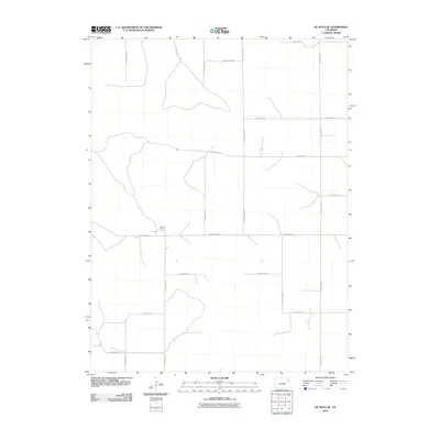
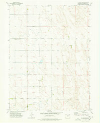
2010 Map of De Nova SE
USGS Topo · Published 2010About this map
Donald Ranch stands as the primary named site in this expansive portion of Yuma County, characterized by a meticulously planned grid of rural transit. The landscape is defined by an extensive network of designated routes, including County Road AAA, County Road XX, and County Road YY, which facilitate movement through this high plains environment. These roads reflect the systematic land partitioning common in Eastern Colorado, where infrastructure follows the cardinal directions to serve isolated agricultural holdings and ranch properties. This 2010 survey by the U.S. Geological Survey captures the area's transition into the twenty-first century, documenting the precise layout of the county's numbered road system, from the northern boundary along County Rd-21 to the southern reaches near County Rd-13.
Find a feature on this map
17 named features on this map. Tap any name to fly to it.
Don’t see what you’re looking for? This feature index may not catch every label — zoom into the map to look around manually.
Map Details
Editions of this 2010 De Nova SE Map
This is the sole edition of this map. No revisions or reprints were ever made.
Other maps of this area

1954 · Limon
USGS Topo · 1:250,000

1957 · Limon
USGS Topo · 1:250,000

1958 · Limon
USGS Topo · 1:250,000

1968 · Joes
USGS Topo · 1:24,000

1974 · De Nova SE
USGS Topo · 1:24,000
1974 · Abarr
USGS Topo · 1:24,000
1974 · De Nova NE
USGS Topo · 1:24,000
1974 · Beverly Grove
USGS Topo · 1:24,000
1974 · De Nova NW
USGS Topo · 1:24,000

1977 · Cope
USGS Topo · 1:24,000