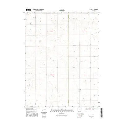
2016 Map of De Nova SE
USGS Topo · Published 2016About this map
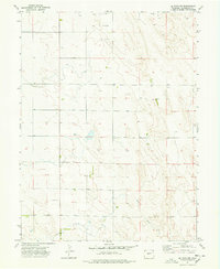
Washington Co and Yuma Co meet along a straight north-south line in this rural section of the High Plains, where the landscape is defined by a rigorous survey grid. The terrain is a series of low undulations, mapped here with fine contour intervals that reveal the subtle drainage patterns of the eastern Colorado steppe. The transportation network is almost entirely comprised of section-line roads, such as Co Rd 16 and Co Rd YY, which facilitate the region's agricultural operations. While largely unpopulated, the map documents the precise division of land through the Public Land Survey System, showing townships like t2s r49w and t3s r48w. This layout reflects the systematic homesteading and ranching heritage of the area, where every square mile was accounted for in the drive for western settlement.
Find a feature on this map
17 named features on this map. Tap any name to fly to it.
Don’t see what you’re looking for? This feature index may not catch every label — zoom into the map to look around manually.
Map Details
Editions of this 2016 De Nova SE Map
This is the sole edition of this map. No revisions or reprints were ever made.
Other maps of this area

1954 · Limon
USGS Topo · 1:250,000

1957 · Limon
USGS Topo · 1:250,000

1958 · Limon
USGS Topo · 1:250,000

1968 · Joes
USGS Topo · 1:24,000

1974 · De Nova SE
USGS Topo · 1:24,000
1974 · Abarr
USGS Topo · 1:24,000
1974 · De Nova NE
USGS Topo · 1:24,000
1974 · Beverly Grove
USGS Topo · 1:24,000
1974 · De Nova NW
USGS Topo · 1:24,000

1977 · Cope
USGS Topo · 1:24,000