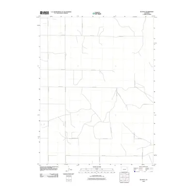
2010 Map of De Nova
USGS Topo · Published 2010About this map
Jack Creek meanders through the northwest corner of this section of Washington County, defining a landscape of wide-open plains and an organized grid of rural corridors. The region is marked by a systematic network of thoroughfares, including County Road QQ, County Road RR, and County Road SS, which facilitate movement across this agricultural terrain. Small water catchments and depressions are scattered among the fields, showing the character of the High Plains drainage patterns at the start of the 21st century. The map provides a clear look at the intersection of local routes such as County Rd-17 and County Road UU, illustrating the spatial organization of Colorado's rural eastern reaches.
Find a feature on this map
15 named features on this map. Tap any name to fly to it.
Don’t see what you’re looking for? This feature index may not catch every label — zoom into the map to look around manually.
Map Details
Editions of this 2010 De Nova Map
This is the sole edition of this map. No revisions or reprints were ever made.
Other maps of this area

1954 · Limon
USGS Topo · 1:250,000

1957 · Limon
USGS Topo · 1:250,000

1958 · Limon
USGS Topo · 1:250,000

1974 · De Nova SE
USGS Topo · 1:24,000
1974 · De Nova NE
USGS Topo · 1:24,000
1974 · De Nova NW
USGS Topo · 1:24,000

1977 · Cope
USGS Topo · 1:24,000

1977 · Arickaree
USGS Topo · 1:24,000
1977 · Elba NE
USGS Topo · 1:24,000

1977 · Elba SE
USGS Topo · 1:24,000