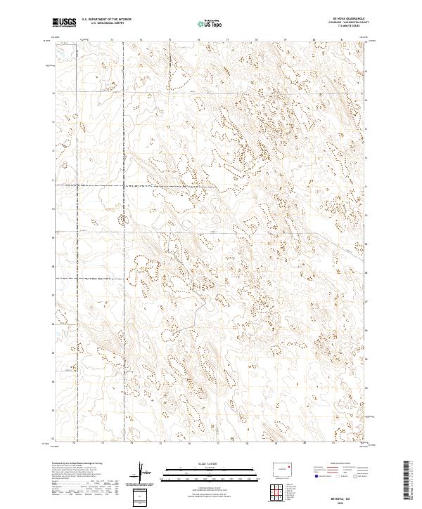
2022 Map of De Nova
USGS Topo · Published 2022About this map
Jack Cr meanders through the northwest corner of this Washington County landscape, which is defined by a sparse network of section lines and gravel paths. This 2022 survey illustrates the high plains character of the region, where infrastructure is minimal and land is meticulously partitioned. The rural layout is marked by routes such as Co Rd 17 and Co Rd 20, which serve the expansive agricultural or grazing tracts within townships like t2s r50w and t3s r49w. Unlike more densely settled areas, the map reveals a terrain where water sources like Jack Cr and the geometry of county roads like Co Rd 14 and Co Rd Qq are the primary landmarks for navigation and land management.
Find a feature on this map
13 named features on this map. Tap any name to fly to it.
Don’t see what you’re looking for? This feature index may not catch every label — zoom into the map to look around manually.
Map Details
Editions of this 2022 De Nova Map
This is the sole edition of this map. No revisions or reprints were ever made.
Other maps of this area

1954 · Limon
USGS Topo · 1:250,000

1957 · Limon
USGS Topo · 1:250,000

1958 · Limon
USGS Topo · 1:250,000

1974 · De Nova SE
USGS Topo · 1:24,000
1974 · De Nova NE
USGS Topo · 1:24,000
1974 · De Nova NW
USGS Topo · 1:24,000

1977 · Cope
USGS Topo · 1:24,000

1977 · Arickaree
USGS Topo · 1:24,000
1977 · Elba NE
USGS Topo · 1:24,000

1977 · Elba SE
USGS Topo · 1:24,000