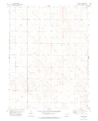
1978 Map of De Nova
USGS Topo · Published 1978About this map
De Nova sits at the heart of this High Plains landscape in Washington County, where the 1970s cattle and energy economy are clearly visible. The terrain is marked by intermittent water sources and industrial development, characterized by the seasonal flow of Jack Creek and the distribution of numerous water wells across the section lines. Petroleum exploration defines much of the land use here, with several Oil Wells and exploratory Drill Holes scattered across the township, reflecting the regional push for resources during this era. The map's grid-like road network and the sparse placement of structures around the De Nova settlement suggest a quiet, agricultural community deeply integrated with the surrounding prairie and its subsurface mineral rights.
Find a feature on this map
5 named features on this map. Tap any name to fly to it.
Don’t see what you’re looking for? This feature index may not catch every label — zoom into the map to look around manually.
Map Details
Editions of this 1978 De Nova Map
This is the sole edition of this map. No revisions or reprints were ever made.
Other maps of this area

1954 · Limon
USGS Topo · 1:250,000

1957 · Limon
USGS Topo · 1:250,000

1958 · Limon
USGS Topo · 1:250,000

1974 · De Nova SE
USGS Topo · 1:24,000
1974 · De Nova NE
USGS Topo · 1:24,000
1974 · De Nova NW
USGS Topo · 1:24,000

1977 · Cope
USGS Topo · 1:24,000

1977 · Arickaree
USGS Topo · 1:24,000
1977 · Elba NE
USGS Topo · 1:24,000

1977 · Elba SE
USGS Topo · 1:24,000