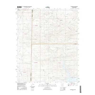
2017 Map of De Queen NW
USGS Topo · Published 2017About this map
De Queen Lake dominates the southeastern corner of this landscape, its waters reaching into the valleys formed by the Rolling Fork and Mill Cr. The terrain is characterized by a series of northwest-to-southeast ridges, including the elevation of Williams Mtn in the north. This 2017 survey documents a region defined by its timber and water resources, straddling the border between Oklahoma and Arkansas. A dense network of logging and rural roads, such as Weyerhaeuser 802 Rd and Forest Rd, indicates active forest management throughout McCurtain and Polk counties. For those researching local history, the map preserves the locations of Oak Grove Cem and Mill Creek Cem, providing specific spatial context for family roots near the junction of Sevier County.
Find a feature on this map
55 named features on this map. Tap any name to fly to it.
Don’t see what you’re looking for? This feature index may not catch every label — zoom into the map to look around manually.
Map Details
Editions of this 2017 De Queen NW Map
This is the sole edition of this map. No revisions or reprints were ever made.
Other maps of this area

1902 · Lukfata
USGS Topo · 1:125,000

1913 · De Queen
USGS Topo · 1:125,000

1950 · Mcalester
USGS Topo · 1:250,000

1959 · Cove
USGS Topo · 1:62,500

1959 · Broken Bow
USGS Topo · 1:62,500

1960 · Smithville
USGS Topo · 1:62,500

1962 · McAlester
USGS Topo · 1:250,000

1964 · Gillham
USGS Topo · 1:24,000

1965 · McAlester
USGS Topo · 1:250,000
1965 · Chapel Hill
USGS Topo · 1:24,000