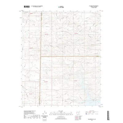
2020 Map of De Queen NW
USGS Topo · Published 2020About this map
The McCurtain County, Oklahoma and Polk County, Arkansas border forms a sharp vertical divide across this terrain, where the Ouachita mountain landscape is defined by a dense network of timber and forest roads. To the west in Oklahoma, the Union Valley Trl and Williams Mtn stand as prominent landmarks, while the Arkansas side is crisscrossed by numerous numbered routes like Polk Road 217 and the Weyerhaeuser 802 Rd.
Find a feature on this map
56 named features on this map. Tap any name to fly to it.
Don’t see what you’re looking for? This feature index may not catch every label — zoom into the map to look around manually.
Map Details
Editions of this 2020 De Queen NW Map
This is the sole edition of this map. No revisions or reprints were ever made.
Other maps of this area

1902 · Lukfata
USGS Topo · 1:125,000

1913 · De Queen
USGS Topo · 1:125,000

1950 · Mcalester
USGS Topo · 1:250,000

1959 · Cove
USGS Topo · 1:62,500

1959 · Broken Bow
USGS Topo · 1:62,500

1960 · Smithville
USGS Topo · 1:62,500

1962 · McAlester
USGS Topo · 1:250,000

1964 · Gillham
USGS Topo · 1:24,000

1965 · McAlester
USGS Topo · 1:250,000
1965 · Chapel Hill
USGS Topo · 1:24,000