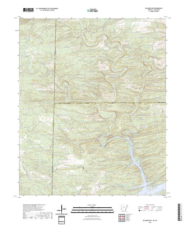
2024 Map of De Queen NW
USGS Topo · Published 2024About this map
Williams Mtn rises as a prominent landmark in the northwest corner of this borderland survey, which straddles the boundary between Oklahoma and Arkansas. The landscape is defined by the drainage network of the Rolling Fork and its numerous tributaries, including Ash Creek, Robinson Creek, and Cane Creek. This modern record reveals a complex grid of rural routes such as Polk Road 4 and Kellum Rd that provide access to the timbered reaches and small agricultural clearings. Cultural sites for genealogical research include the Oak Grove Cem and a second Cem located near the southern margin. The terrain transitions from higher elevations in the north toward the flatter bottomlands of Mill Creek in the south, reflecting the persistent rural character of the Sevier County and Polk County regions at the state line.
Find a feature on this map
59 named features on this map. Tap any name to fly to it.
Don’t see what you’re looking for? This feature index may not catch every label — zoom into the map to look around manually.
Map Details
Editions of this 2024 De Queen NW Map
This is the sole edition of this map. No revisions or reprints were ever made.
Other maps of this area

1902 · Lukfata
USGS Topo · 1:125,000

1913 · De Queen
USGS Topo · 1:125,000

1950 · Mcalester
USGS Topo · 1:250,000

1959 · Cove
USGS Topo · 1:62,500

1959 · Broken Bow
USGS Topo · 1:62,500

1960 · Smithville
USGS Topo · 1:62,500

1962 · McAlester
USGS Topo · 1:250,000

1964 · Gillham
USGS Topo · 1:24,000

1965 · McAlester
USGS Topo · 1:250,000
1965 · Chapel Hill
USGS Topo · 1:24,000