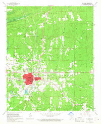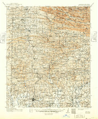
1913 Map of De Queen
USGS Topo · Published 1949About this map
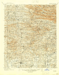
De Queen serves as the focal point for this survey of southwest Arkansas and southeast Oklahoma, illustrating a landscape defined by the Kansas City Southern Railway corridor. The geography transitions from the mountainous ridges of the Ouachita National Forest in the north, including landmarks like Bee Mtn and Boar Tusk Mtn, to the river valleys and creek bottoms of the south. A dense network of community infrastructure is visible, with numerous country schools such as Welcome Home School and Scroungeout School serving rural families. The presence of the Spring Valley Mine and the Flowers Mill Crossing reflects the era's reliance on local mineral and timber resources. Because few bridges spanned the region's waterways during the original survey period, travelers relied on established crossings like Planer Ford and Cow Creek Ford to navigate the Rolling Fork and Saline River.
Find a feature on this map
215 named features on this map. Tap any name to fly to it.
Don’t see what you’re looking for? This feature index may not catch every label — zoom into the map to look around manually.
Map Details
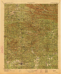
Editions of this 1913 De Queen Map
4 editions found
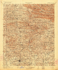
Historical Maps of De Queen Through Time
8 maps found