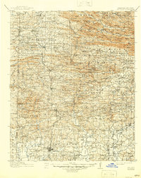
1913 Map of De Queen
USGS Topo · Published 1945About this map
De Queen serves as the focal point of this regional study, which documents the rugged transition from the southern Ouachita National Forest into the river valleys of southwest Arkansas and southeast Oklahoma. The Kansas City Southern RR is the primary industrial artery, connecting timber and mining towns like Hatfield, Vandervoort, Wickes, and Gillham. This era shows a landscape dense with rural infrastructure, including dozens of local education centers such as Welcome Home School and Blanchard School, alongside spiritual landmarks like Smyrna Church and Cecil Chapel. The topographical survey tracks the complex drainage of the Cossatot River and Little River, highlighting early industrial sites like Baker Min and remote outposts such as Ultima Thule. These details provide a look at the settlement patterns established before modern highway expansion reshaped the Ouachita foothills.
Find a feature on this map
249 named features on this map. Tap any name to fly to it.
Don’t see what you’re looking for? This feature index may not catch every label — zoom into the map to look around manually.
Map Details
Editions of this 1913 De Queen Map
4 editions found
Other maps of this area

1890 · Mount Ida
USGS Topo · 1:125,000

1890 · Poteau Mountain
USGS Topo · 1:125,000

1899 · Poteau Mountain
USGS Topo · 1:125,000

1900 · Winding Stair
USGS Topo · 1:125,000

1902 · Lukfata
USGS Topo · 1:125,000

1906 · Caddo Gap
USGS Topo · 1:125,000

1909 · Winding Stair
USGS Topo · 1:125,000

1913 · De Queen
USGS Topo · 1:125,000

1936 · Athens
USGS Topo · 1:48,000

1942 · Athens
USGS Topo · 1:62,500