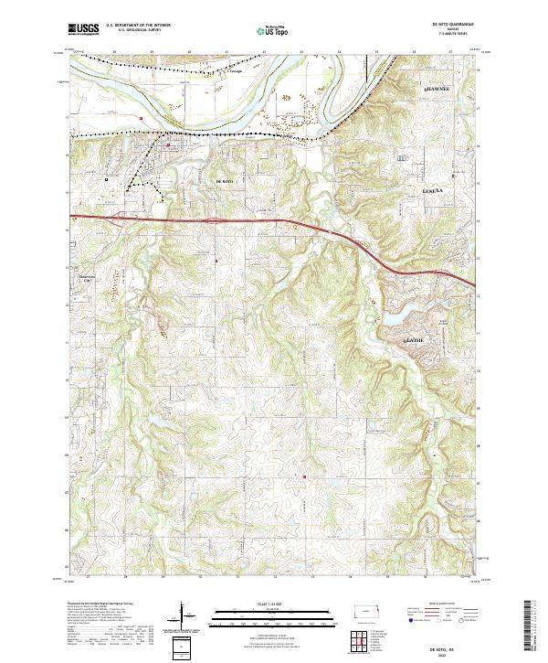
2022 Map of De Soto
USGS Topo · Published 2022About this map
The Kansas River winds through the northern reaches of this landscape, carving a wide valley that defines the boundary between De Soto and Lenape. This modern survey documents a region of rapid suburban transition where the western edges of Shawnee, Lenexa, and Olathe meet the more open terrain of western Johnson County. The topography is defined by the branching drainages of Kill Creek and Cedar Creek, which have shaped the local road grid and settlement patterns for generations.
Find a feature on this map
53 named features on this map. Tap any name to fly to it.
Don’t see what you’re looking for? This feature index may not catch every label — zoom into the map to look around manually.
Map Details
Editions of this 2022 De Soto Map
This is the sole edition of this map. No revisions or reprints were ever made.
Other maps of this area

1885 · Lawrence
USGS Topo · 1:125,000

1886 · Oskaloosa
USGS Topo · 1:125,000

1887 · Olathe
USGS Topo · 1:125,000

1888 · Oskaloosa
USGS Topo · 1:125,000

1889 · Lawrence
USGS Topo · 1:125,000

1890 · Kansas City
USGS Topo · 1:125,000

1893 · Olathe
USGS Topo · 1:125,000

1894 · Kansas City
USGS Topo · 1:125,000

1894 · Oskaloosa
USGS Topo · 1:125,000

1934 · Bonner Springs
USGS Topo · 1:48,000