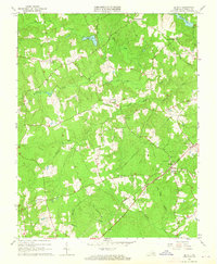
1963 Map of De Witt
USGS Topo · Published 1965About this map
De Witt serves as the focal point for this Virginia quadrangle, situated at a vital junction of the Seaboard Air Line railroad. This 1963 survey illustrates a landscape defined by small crossroads settlements and family-named landmarks, reflecting the rural character of Dinwiddie County during the mid-century. Significant local institutions include the De Witt Sch, Prospect Ch, and Bott Memorial Ch, which highlight the social fabric of these communities.
Find a feature on this map
31 named features on this map. Tap any name to fly to it.
Don’t see what you’re looking for? This feature index may not catch every label — zoom into the map to look around manually.
Map Details
Editions of this 1963 De Witt Map
3 editions found
Other maps of this area

1897 · Amelia
USGS Topo · 1:125,000

1918 · Lawrenceville
USGS Topo · 1:62,500

1919 · Mc Kenney
USGS Topo · 1:48,000

1920 · Lawrenceville
USGS Topo · 1:48,000

1921 · Mc Kenney
USGS Topo · 1:62,500

1921 · Lawrenceville
USGS Topo · 1:62,500

1942 · Lawrenceville
USGS Topo · 1:62,500

1943 · Mc Kenney
USGS Topo · 1:62,500

1943 · De Witt
USGS Topo · 1:24,000

1943 · Dinwiddie
USGS Topo · 1:24,000