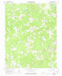
1963 Map of De Witt
USGS Topo · Published 1977About this map
De Witt and the surrounding rural landscapes of Dinwiddie County are captured in this mid-century survey, revealing a network of small crossroads communities and family landmarks. The Seaboard Coast Line railroad serves as the primary industrial artery, running through the heart of the area near Butterworth. This region is defined by its deep community roots, evidenced by numerous country churches such as Bott Memorial Ch and Eleven Oaks Ch, alongside educational hubs like the De Witt Sch.
Find a feature on this map
32 named features on this map. Tap any name to fly to it.
Don’t see what you’re looking for? This feature index may not catch every label — zoom into the map to look around manually.
Map Details
Editions of this 1963 De Witt Map
3 editions found
Other maps of this area

1897 · Amelia
USGS Topo · 1:125,000

1918 · Lawrenceville
USGS Topo · 1:62,500

1919 · Mc Kenney
USGS Topo · 1:48,000

1920 · Lawrenceville
USGS Topo · 1:48,000

1921 · Mc Kenney
USGS Topo · 1:62,500

1921 · Lawrenceville
USGS Topo · 1:62,500

1942 · Lawrenceville
USGS Topo · 1:62,500

1943 · Mc Kenney
USGS Topo · 1:62,500

1943 · De Witt
USGS Topo · 1:24,000

1943 · Dinwiddie
USGS Topo · 1:24,000