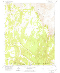
1963 Map of Dead Horse Flat
USGS Topo · Published 1978About this map
Nellis Air Force Range and the Nevada Test Site dominate this mid-century topographic record, reflecting the intense military and scientific activity of the Cold War era in Nye County. The landscape is defined by the high plateau of Dead Horse Flat, bordered by deep drainages such as North Silent Canyon and South Silent Canyon. The map is unique for its focus on restricted government lands during the height of atomic testing, showing the Military Reservation Boundary Test Site Boundary that separated different zones of strategic operations. Despite the heavy federal presence, the map preserves older terrain names like Grass Spring Canyon and Basket Valley, providing a look at the geography before it was fully enveloped by specialized military designations.
Find a feature on this map
12 named features on this map. Tap any name to fly to it.
Don’t see what you’re looking for? This feature index may not catch every label — zoom into the map to look around manually.
Map Details
Editions of this 1963 Dead Horse Flat Map
2 editions found
Other maps of this area

1908 · Kawich
USGS Topo · 1:250,000

1942 · Wheelbarrow Peak
USGS Topo · 1:125,000

1952 · Tippipah Spring
USGS Topo · 1:62,500

1952 · Timber Mountain
USGS Topo · 1:62,500

1952 · Wheelbarrow Peak
USGS Topo · 1:62,500

1952 · Silent Canyon
USGS Topo · 1:62,500

1954 · Goldfield
USGS Topo · 1:250,000

1955 · Goldfield
USGS Topo · 1:250,000

1958 · Goldfield
USGS Topo · 1:250,000
1961 · Ammonia Tanks
USGS Topo · 1:24,000