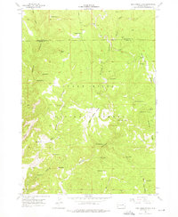
1955 Map of Dead Horse Flats
USGS Topo · Published 1976About this map
Black Hills National Forest land defines this mid-century landscape on the border of Pennington and Custer counties. The terrain is characterized by a dense network of draws and canyons, including the winding Gillette Canyon and Dead Horse Canyon, which drain the elevated Dead Horse Flats. Scattered ranching outposts like Wilson Ranch and Pitts Ranch mark the sparse human presence in a territory where water sources were the primary landmarks.
Find a feature on this map
43 named features on this map. Tap any name to fly to it.
Don’t see what you’re looking for? This feature index may not catch every label — zoom into the map to look around manually.
Map Details
Editions of this 1955 Dead Horse Flats Map
3 editions found
Other maps of this area

1896 · Harney Peak
USGS Topo · 1:125,000

1899 · Newcastle
USGS Topo · 1:125,000

1901 · Harney Peak
USGS Topo · 1:125,000

1901 · Newcastle
USGS Topo · 1:125,000

1951 · Fanny Peak
USGS Topo · 1:24,000

1951 · Clifton
USGS Topo · 1:24,000

1955 · Dead Horse Flats
USGS Topo · 1:24,000

1955 · Jewel Cave NW
USGS Topo · 1:24,000

1955 · Jewel Cave
USGS Topo · 1:24,000

1955 · Signal Hill
USGS Topo · 1:24,000