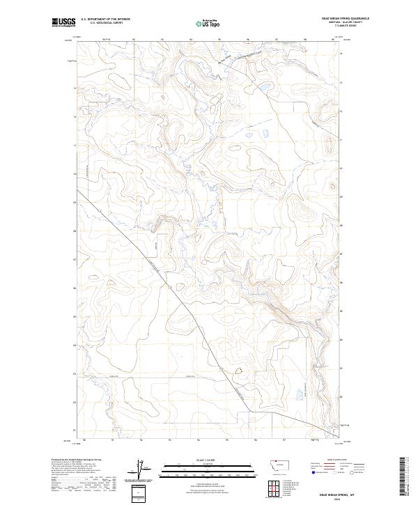
2024 Map of Dead Indian Spring
USGS Topo · Published 2024About this map
Dead Indian Spring is a central focal point in this portion of Glacier County, situated in a high-prairie landscape defined by seasonal water sources and expansive coulees. The terrain is marked by the drainage of Big Rock Coulee and its East Fork, which carve through the open range alongside Coyote Springs. The mapping reflects a sparse, ranch-oriented infrastructure where movement depends on long, linear routes like Chalk Butte Rd and Dudley Rd.
Find a feature on this map
14 named features on this map. Tap any name to fly to it.
Don’t see what you’re looking for? This feature index may not catch every label — zoom into the map to look around manually.
Map Details
Editions of this 2024 Dead Indian Spring Map
This is the sole edition of this map. No revisions or reprints were ever made.
Other maps of this area

1907 · Blackfoot Res.
USGS Topo · 1:48,000

1909 · Cut Bank
USGS Topo · 1:125,000

1911 · Blackfoot
USGS Topo · 1:125,000

1912 · Cut Bank
USGS Topo · 1:125,000

1960 · Cut Bank
USGS Topo · 1:250,000

1963 · Cut Bank
USGS Topo · 1:250,000

1964 · Cut Bank
USGS Topo · 1:250,000
1966 · Cut Bank
USGS Topo · 1:24,000
1966 · Gunsight
USGS Topo · 1:24,000

1968 · Headlight Butte NE
USGS Topo · 1:24,000