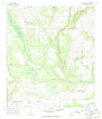
1957 Map of Dead Tiger Creek
USGS Topo · Published 1971About this map
Mississippi Test Facility (NASA) marks the southern edge of this Hancock County landscape, reflecting the space-age transformation of the Mississippi Gulf Coast in the mid-20th century. The terrain is defined by a dense network of waterways, including Catahoula Creek and Dead Tiger Creek, which feed into expansive wetlands and named inlets like Sam Farve Bay and Josephs Bay. This environment dictated a sparse settlement pattern, where small rural hubs like Harmony Ch and Bienville Ch served the local community. Evidence of earlier rural life appears at the Flattop Sch (Abandoned), while the interior is punctuated by geographical features such as Adgreen Bay and Turtleskin Creek. The presence of a Flowing Well and several towers suggests a transition from traditional land use to a modern, technologically integrated infrastructure supporting the aerospace industry nearby.
Find a feature on this map
23 named features on this map. Tap any name to fly to it.
Don’t see what you’re looking for? This feature index may not catch every label — zoom into the map to look around manually.
Map Details
Editions of this 1957 Dead Tiger Creek Map
4 editions found

Other maps of this area

1914 · Nicholson
USGS Topo · 1:62,500

1921 · Nicholson
USGS Topo · 1:62,500

1941 · Honey Island
USGS Topo · 1:31,680

1950 · Haaswood
USGS Topo · 1:31,680

1953 · Mobile
USGS Topo · 1:250,000

1954 · Haaswood
USGS Topo · 1:31,680

1955 · Savannah
USGS Topo · 1:62,500

1955 · Nicholson
USGS Topo · 1:24,000

1956 · Waveland
USGS Topo · 1:24,000

1957 · Mobile
USGS Topo · 1:250,000