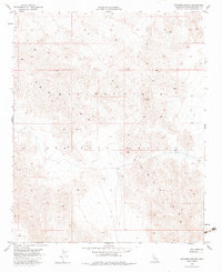
1955 Map of Deadman Lake NE
USGS Topo · Published 1983About this map
The Bullion Mountains dominate this high-desert terrain in San Bernardino County, where the landscape is defined by the needs of national defense. This 1955 survey illustrates a portion of the Marine Corps Training Center, a vast military range where the topography itself serves as the primary infrastructure. The map reveals a strictly functional environment, with minimal development beyond a network of unimproved dirt roads that thread through the complex drainage patterns and elevation changes of the mountain range. Unlike more settled regions, this area shows an absence of civilian architecture or industry, emphasizing the transition of the California desert into a dedicated zone for tactical preparation during the mid-20th century. For historians and researchers, the sheet provides a precise record of the training grounds before subsequent expansion, capturing the isolation and specific geographic utility of this part of the Mojave.
Find a feature on this map
3 named features on this map. Tap any name to fly to it.
Don’t see what you’re looking for? This feature index may not catch every label — zoom into the map to look around manually.
Map Details
Editions of this 1955 Deadman Lake NE Map
5 editions found

Other maps of this area

1942 · Amboy
USGS Topo · 1:250,000

1943 · Amboy
USGS Topo · 1:250,000

1953 · San Bernardino
USGS Topo · 1:250,000

1954 · Needles
USGS Topo · 1:250,000

1954 · Bagdad SW
USGS Topo · 1:24,000

1954 · Ludlow SE
USGS Topo · 1:24,000

1955 · Deadman Lake NW
USGS Topo · 1:24,000

1955 · Morgans Well
USGS Topo · 1:24,000

1955 · Lead Mountain
USGS Topo · 1:24,000

1955 · Deadman Lake SE
USGS Topo · 1:24,000