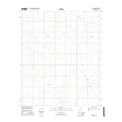
2017 Map of Dean Ranch
USGS Topo · Published 2017About this map
Dean Ranch stands as the primary named settlement in this high plains expanse of Lea County, marking a landscape defined by expansive ranching operations and long-distance land management. The 2017 survey documents a network of private and county thoroughfares, including Warren Rd and Jerry Ln, which facilitate movement between the vast sections of the Public Land Survey System. Grid coordinates for t14s r32e and t15s r33e delineate the administrative organization of the territory. This map records the subtle topography of a region where water and access roads dictate the placement of human activity, providing a detailed look at the rural infrastructure required to maintain large-scale livestock and land interests in eastern New Mexico.
Find a feature on this map
8 named features on this map. Tap any name to fly to it.
Don’t see what you’re looking for? This feature index may not catch every label — zoom into the map to look around manually.
Map Details
Editions of this 2017 Dean Ranch Map
This is the sole edition of this map. No revisions or reprints were ever made.
Other maps of this area

1954 · Hobbs
USGS Topo · 1:250,000

1954 · Brownfield
USGS Topo · 1:250,000

1958 · Brownfield
USGS Topo · 1:250,000

1958 · Hobbs
USGS Topo · 1:250,000

1962 · Brownfield
USGS Topo · 1:250,000

1962 · Buckeye
USGS Topo · 1:62,500

1963 · Maljamar
USGS Topo · 1:62,500

1973 · Fort Ranch
USGS Topo · 1:24,000

1973 · Caudill Ranch
USGS Topo · 1:24,000

1973 · Cooper-Good Ranch
USGS Topo · 1:24,000