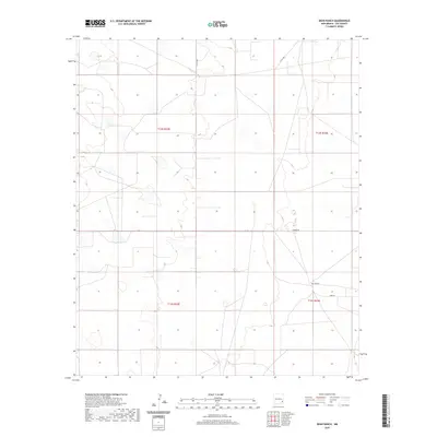
2020 Map of Dean Ranch
USGS Topo · Published 2020About this map
Dean Ranch serves as the primary landmark in this sparsely populated stretch of the Llano Estacado in Lea County. The landscape is defined by the Public Land Survey System grid, which segments the territory into townships such as t14s r33e and t15s r33e. Transportation through this arid region relies on a network of functional ranch roads and county routes, including Co Rd 108a, Warren Rd, and Jerry Ln. These roads often follow the section lines of the survey, a characteristic pattern of New Mexico's high plains development where infrastructure is tied directly to land allotment and large-scale ranching operations. The presence of T-117 suggests the systematic numbering of remote access paths used for ranching and resource management in the late twentieth and early twenty-first centuries.
Find a feature on this map
9 named features on this map. Tap any name to fly to it.
Don’t see what you’re looking for? This feature index may not catch every label — zoom into the map to look around manually.
Map Details
Editions of this 2020 Dean Ranch Map
This is the sole edition of this map. No revisions or reprints were ever made.
Other maps of this area

1954 · Hobbs
USGS Topo · 1:250,000

1954 · Brownfield
USGS Topo · 1:250,000

1958 · Brownfield
USGS Topo · 1:250,000

1958 · Hobbs
USGS Topo · 1:250,000

1962 · Brownfield
USGS Topo · 1:250,000

1962 · Buckeye
USGS Topo · 1:62,500

1963 · Maljamar
USGS Topo · 1:62,500

1973 · Fort Ranch
USGS Topo · 1:24,000

1973 · Caudill Ranch
USGS Topo · 1:24,000

1973 · Cooper-Good Ranch
USGS Topo · 1:24,000