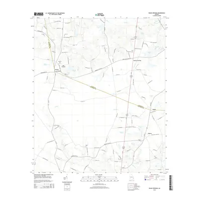
2014 Map of Deans Crossing
USGS Topo · Published 2014About this map
Deans Crossing anchors this Georgia landscape where the boundary between Evans and Tattnall counties follows a diagonal course through agricultural and wooded terrain. Family-named sites like Daniels and Bay Branch highlight the importance of local lineage, with genealogical markers including Kennedy Cem, Hammock Cem, and Bay Branch Cem scattered throughout the rural corridors. The hydrology is dominated by a network of creeks and ponds, including Bull Cr and Beards Cr, which feed into larger bodies such as Gartrell Lake and Durrence Lake. In the southern reaches, the Blocker Ford crossing near Midway suggests historical transit points across Blocker Cr before modern road improvements. The map provides a detailed view of the road network, including the Us 301 corridor and numerous named rural routes like HLN Julia Brewton Rd and Gary Bell Rd.
Find a feature on this map
112 named features on this map. Tap any name to fly to it.
Don’t see what you’re looking for? This feature index may not catch every label — zoom into the map to look around manually.
Map Details
Editions of this 2014 Deans Crossing Map
This is the sole edition of this map. No revisions or reprints were ever made.
Other maps of this area

1919 · Claxton
USGS Topo · 1:62,500

1920 · Glennville
USGS Topo · 1:62,500

1944 · Claxton
USGS Topo · 1:62,500

1944 · Glennville
USGS Topo · 1:62,500

1946 · Brunswick
USGS Topo · 1:250,000

1947 · Savannah
USGS Topo · 1:250,000

1948 · Brunswick
USGS Topo · 1:250,000

1948 · Savannah
USGS Topo · 1:250,000

1950 · Glennville
USGS Topo · 1:62,500

1950 · Claxton
USGS Topo · 1:62,500