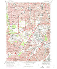
1968 Map of Dearborn
USGS Topo · Published 1974About this map
Industrial might and mid-century suburban expansion define this study of Dearborn and its neighbors in the late 1960s. The landscape is dominated by the sprawling Proving Ground and the cultural landmark of Greenfield Village, alongside the academic grounds of Henry Ford College and the University of Michigan (Dearborn Campus). The map documents the intricate transportation network of the era, from the massive Turning Basin on the River Rouge to the complex rail yards of the Chesapeake and Ohio and Pennsylvania railroads.
Find a feature on this map
151 named features on this map. Tap any name to fly to it.
Don’t see what you’re looking for? This feature index may not catch every label — zoom into the map to look around manually.
Map Details
Editions of this 1968 Dearborn Map
4 editions found
Other maps of this area

1905 · Wayne
USGS Topo · 1:62,500

1905 · Detroit
USGS Topo · 1:62,500

1906 · Wyandotte
USGS Topo · 1:62,500

1906 · Romulus
USGS Topo · 1:62,500

1912 · Wyandotte
USGS Topo · 1:62,500

1912 · Wayne
USGS Topo · 1:62,500

1918 · Detroit
USGS Topo · 1:62,500

1924 · Detroit
USGS Topo · 1:62,500

1928 · Romulus
USGS Topo · 1:62,500

1929 · Wyandotte
USGS Topo · 1:62,500