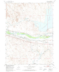
1951 Map of Dearfield
USGS Topo · Published 1974About this map
The South Platte River corridor in Weld County reveals a highly managed agricultural landscape at the start of the 1950s. The region is defined by an intricate network of irrigation works, including the Riverside Canal, Empire Canal, and Bijou Canal, which divert water to support the surrounding plains. The settlement of Dearfield stands near the river's northern banks, while prominent named holdings such as Eagles Nest Ranch, Reverse K Four Ranch, and F Quarter Circle Ranch illustrate the era's ranching economy.
Find a feature on this map
14 named features on this map. Tap any name to fly to it.
Don’t see what you’re looking for? This feature index may not catch every label — zoom into the map to look around manually.
Map Details
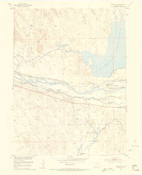
Editions of this 1951 Dearfield Map
2 editions found
Other maps of this area

1950 · Greasewood Lake
USGS Topo · 1:24,000

1950 · Tampa
USGS Topo · 1:24,000

1950 · Barnesville
USGS Topo · 1:24,000

1950 · Masters
USGS Topo · 1:24,000

1950 · Hardin
USGS Topo · 1:24,000

1951 · Masters
USGS Topo · 1:24,000

1951 · Hardin
USGS Topo · 1:24,000

1951 · Roggen
USGS Topo · 1:24,000

1951 · Omar
USGS Topo · 1:24,000

1951 · Point Of Rocks
USGS Topo · 1:24,000