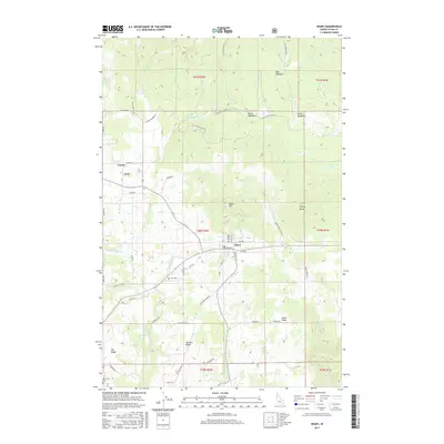
2017 Map of Deary
USGS Topo · Published 2017About this map
Deary serves as the primary hub in this corner of Latah County, situated where the high plateaus of Texas Ridge and Big Bear Ridge meet the timbered foothills. The settlement pattern here reflects a classic Western transition from agricultural ridges to upland meadows, with small communities like Avon and Vassar anchoring the northern reaches. The landscape is deeply incised by the drainage systems of Big Bear Cr and Pine Cr, which flow toward the Potlatch River in the southeast.
Find a feature on this map
60 named features on this map. Tap any name to fly to it.
Don’t see what you’re looking for? This feature index may not catch every label — zoom into the map to look around manually.
Map Details
Editions of this 2017 Deary Map
This is the sole edition of this map. No revisions or reprints were ever made.
Other maps of this area

1955 · Pullman
USGS Topo · 1:250,000

1958 · Pullman
USGS Topo · 1:250,000

1961 · Deary
USGS Topo · 1:62,500

1961 · Kendrick
USGS Topo · 1:62,500

1961 · Ahsahka
USGS Topo · 1:62,500

1961 · Bovill
USGS Topo · 1:62,500

1981 · Potlatch
USGS Topo · 1:100,000
1990 · Stanford
USGS Topo · 1:24,000
1990 · Harvard
USGS Topo · 1:24,000
1990 · Texas Ridge
USGS Topo · 1:24,000