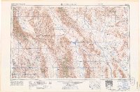
1965 Map of Death Valley
USGS Topo · Published 1965About this map
Death Valley National Monument dominates this mid-century landscape, revealing a complex network of springs and mining sites across the Panamint Range and Funeral Mountains. The map provides an incredible record of early desert habitation, marking several notable locations such as Skidoo, Harrisburg, and Chloride City. To the west, the Inyo Mountains and Argus Range frame the Panamint Valley, while the eastern portion of the sheet transitions into the restricted zones of the Nevada Proving Grounds and Nellis Air Force Base Range. This era of the desert is defined by its industrial and agricultural pockets, from the Santa Rosa Mines near Darwin to the Furnace Creek Ranch. The path of the Tonopah and Tidewater Railroad is still visible, serving as a reminder of the rail-driven economy that once connected these remote mining camps and settlements like Ballarat and Rhyolite.
Find a feature on this map
61 named features on this map. Tap any name to fly to it.
Don’t see what you’re looking for? This feature index may not catch every label — zoom into the map to look around manually.
Map Details
Editions of this 1965 Death Valley Map
This is the sole edition of this map. No revisions or reprints were ever made.
Other maps of this area

1905 · Olancha
USGS Topo · 1:125,000

1906 · Kernville
USGS Topo · 1:125,000

1907 · Olancha
USGS Topo · 1:125,000

1907 · Mt. Whitney
USGS Topo · 1:125,000

1907 · Las Vegas
USGS Topo · 1:250,000

1908 · Kawich
USGS Topo · 1:250,000

1908 · Lida
USGS Topo · 1:250,000

1908 · Furnace Creek
USGS Topo · 1:250,000

1908 · Las Vegas
USGS Topo · 1:250,000

1908 · Kernville
USGS Topo · 1:125,000